Attribute
Detail
Format
Recorded Lectures (Self-Paced)
Level
Moderate
Duration
3 Days (60-90 Minutes each day)
Certification
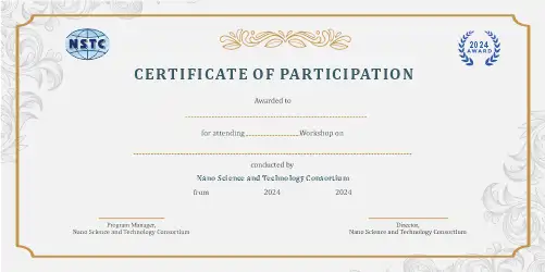
e-Certification + e-Marksheet
Tools
Drones, Sentinel-1/2, Landsat, MODIS/VIIRS, PM₂.₅/NO₂/O₃ sensors, STAC
About the Ai Environmental Monitoring Course
“Eyes in the Sky” is a concise, hands-on course on using drones, satellites, and AI for real-time environmental monitoring.
Through the Silvanet & Silvaguard case study, you’ll see how remote sensing and ML fuse to detect deforestation and wildfires, track air quality, and estimate emissions and vegetation carbon stocks—while addressing real-world hurdles like data gaps, accuracy, and scaling in low-resource regions. This program will equip you with the skills to leverage cutting-edge technology for critical environmental challenges, transforming pixels into protection.
Program Highlights
• Comprehensive coverage of Eyes in the Sky from fundamentals to advanced applications
• Hands-on projects and real-world case studies in AI
• Expert-curated curriculum aligned with current industry standards
• Access to recorded lectures and e-LMS platform for flexible, self-paced learning
• e-Certification and e-Marksheet upon successful completion
• Dedicated mentor support and interactive doubt-clearing sessions
• Practical experience with tools: Drones, Sentinel-1/2, Landsat, MODIS/VIIRS
• Career-oriented training for academic and professional growth in AI
Course Curriculum
Module 1: Foundations of Environmental Remote Sensing
- Define scope & requirements for environmental monitoring (deforestation, wildfire, air quality).
- Examine various platforms and payloads: UAS (RGB/TIR), public satellites (Sentinel-1/2, Landsat, MODIS/VIIRS), and ground AQ sensors (PM₂.₅/NO₂/O₃).
- Understand data plumbing techniques including orthorectification, tiling, STAC, and cloud/gap handling.
Module 2: AI for Deforestation & Wildfire Detection
- Implement change detection and early-warning models for deforestation and wildfires.
- Apply techniques for wildfire detection: TIR/VIIRS anomaly flags, smoke segmentation, and alert thresholds.
- Analyze deforestation using time-series change (BFAST/Delta), semantic segmentation, and accuracy assessment.
Module 3: Air Quality & Carbon Estimation with AI
- Fuse EO (AOD) with ground air quality data, perform bias correction, and nowcast under missing data scenarios.
- Estimate carbon and emissions using multispectral+SAR biomass and FRP→emissions relationships, including uncertainty bands.
- Explore the Silvanet & Silvaguard case study to understand real-world application of early warning and integration.
Module 4: Data Fusion and Scaling Challenges
- Fuse multi-resolution data (UAV + EO + IoT) for robust signal detection in environmental monitoring.
- Address data gaps, accuracy limits, and scaling issues in low-resource contexts effectively.
- Implement deployment strategies at scale including robustness, drift monitoring, human-on-the-loop, and low-bandwidth constraints.
Module 5: Hands-On Lab: End-to-End AOI Build
- Create a STAC-indexed Area of Interest (AOI) data lake incorporating Sentinel-2, VIIRS, and drone scene data.
- Run a complete pipeline: cloud mask → wildfire/smoke flags → forest-loss polygons (with confidence).
- Fuse EO + ground AQ data to produce a daily bias-corrected PM map.
Module 6: Dashboarding & Decision Support
- Estimate stand-level carbon with basic uncertainty for environmental impact assessment.
- Publish a lightweight dashboard displaying alerts, loss, AQ index, and carbon snapshots for decision support.
- Prototype a minimal alerting workflow and web map for efficient communication of environmental insights.
Tools, Techniques, or Platforms Covered
Drones
Sentinel-1/2
Landsat
MODIS/VIIRS
PM₂.₅/NO₂/O₃ sensors
STAC
BFAST/Delta
Python
Real-World Applications
- Apply Eyes in the Sky skills directly to academic research, thesis work, and publications
- Build a professional portfolio showcasing practical AI competencies
- Solve industry-relevant problems using Eyes in the Sky methodologies and tools
- Contribute to open-source projects and collaborative research in AI
- Prepare for competitive examinations, interviews, and professional certifications in AI
Who Should Attend & Prerequisites
- Industry-recognized e-Certification + e-Marksheet from NSTC
- Hands-on training with practical projects and industrial datasets
- Dedicated expert mentorship and doubt resolution
Prerequisites:
Frequently Asked Questions
1. What is the format of this Eyes in the Sky: AI for Real-Time Environmental Monitoring course?
This is an Recorded Lectures (Self-Paced) course delivered via our e-LMS platform. You will have access to pre-recorded video lectures, reading materials, assignments, quizzes, and hands-on projects that you can complete at your own pace.
2. Will I receive a certificate after completing this course?
Yes! Upon successful completion of all modules, assignments, and assessments, you will receive an e-Certification along with an e-Marksheet from NanoSchool (NSTC) that you can showcase on your CV and LinkedIn profile.
3. What are the prerequisites for this course?
No prior experience is required. This course is designed for beginners and takes you step by step from the basics to advanced topics.
4. How long will I have access to the course materials?
You will have access to all course materials for the duration of 3 Days (60-90 Minutes each day). The self-paced format allows you to learn according to your own schedule through our online learning management system.
5. Is mentor support available during the course?
Yes, dedicated mentor support is available throughout the course. You can reach out for doubt-clearing sessions, project guidance, and career advice related to AI. Our mentors are industry experts and experienced professionals.
Enroll in Eyes in the Sky: AI for Real-Time Environmental Monitoring today and take the next step in your professional journey. With expert-curated content, practical projects, and industry-recognized certification, this course is your gateway to mastering AI skills that matter.